
What is MapTiles?
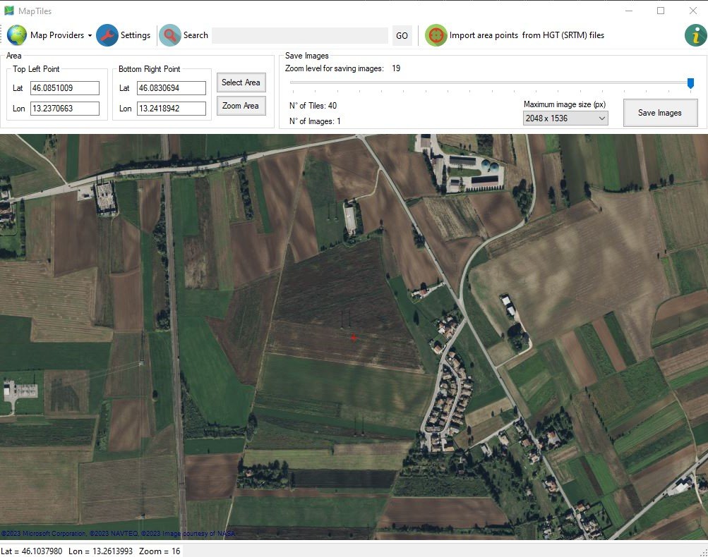
MapTiles is the new freeware software by DIGICORP Ingegneria that allows the visualization of maps provided by various providers (Bing, Google, Open Cycle, Ovi, ArcGIS World).
The user can select a specific area of the map and download it as images, choosing a certain zoom level and the maximum size of each downloaded image.
The higher the zoom level, the greater the level of detail of the images.
It is also possible to download 3D points in HGT format (NASA SRTM).
The features of MapTiles are already included in CIVIL Design and CAD&Pillar products.
Compared to the freeware version, these products can automatically georeference images and points saved in a reference system chosen by the user.
Notes
The software is released for free use and no support of any kind is provided.
The software is available in English only.
Given the simplicity of use of the application, a user manual will not be provided.
Requirements
-
Microsoft® operating systems:
Windows® 11, 10.
Requires .NET Framework 4 installed
Requires an Internet connection
